

About us
News
See all

2024-07-22
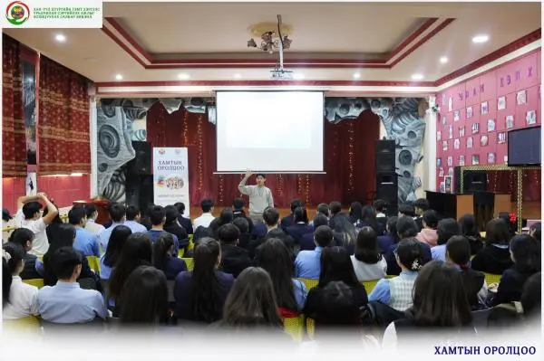
"Participation" training was organized on March 5 and 6, 2024, for high school students of district general education schools No. 26 and 60.
Published by:Khanuul
2024-07-22
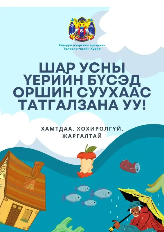
Please refuse to live in flood zone!!!
Published by:Khanuul
2024-07-22
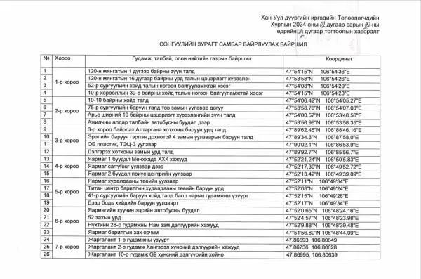
We are informing the public about the location of the election billboards of the State Great Khural in the territory of Khan-Uul district.
Published by:Khanuul

2024-07-22
The "Traffic Alphabet 2024" competition was held on April 23, 2024.
Published by:Khanuul
About Us
The Tuul River flows through central and northern Mongolia. It is 704 km long and has a catchment area of 49,840 km2. It flows through Khentii, Tuv, Selenge aimags and Ulaanbaatar. The height of the basin is between 770 and 2800 meters, the highest point is Asralt Khairkhan Mountain at 2799.3 meters above sea level, and the lowest point is the Orkhon-Tuul delta at 770 meters above sea level.
Contact Us
SUB ORGANIZATIONS
RELATED ORGANIZATIONS
INTRODUCTION
ИЛ ТОД БАЙДАЛ
LAW
District Governor
Baasan Tseren
Khan-Uul District Governor
Management team

Amgalanbayar Amartuvshin
Deputy Governor of Khan-Uul District

Sanjmyatav Enkhbayar
Head of the Governor's Office of Khan-Uul District
Subscribe
If you want to receive new updates regularly without delay, please enter your email here to subscribe.
